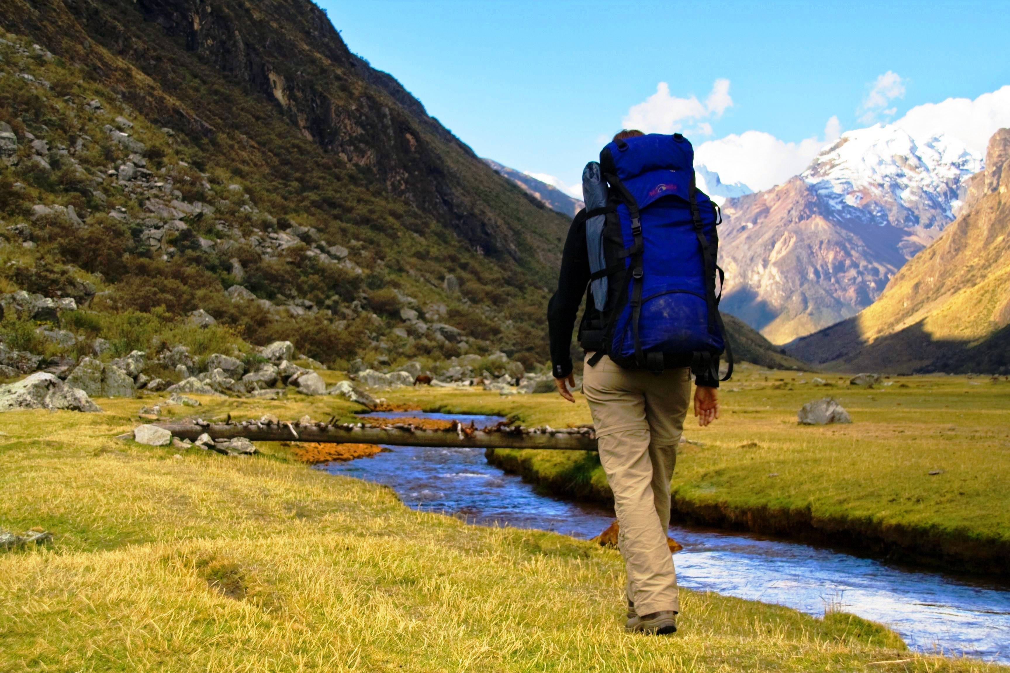
Some people have the idea that trekking is all sweat and hard work with no fun. This is far from the truth. Days are designed to be challenging, but not exhausting. Langtang was designated as Nepal’s first National park in 1971.
Four days hiking up through this beautiful alpine valley to Kyangjin where we rest for a day for some exploration of the high mountains and glacial systems. Trackback for three days before a journey to the Sacred lakes of Gosainkunda a major pilgrimage sight for both Hindus and Buddhists.
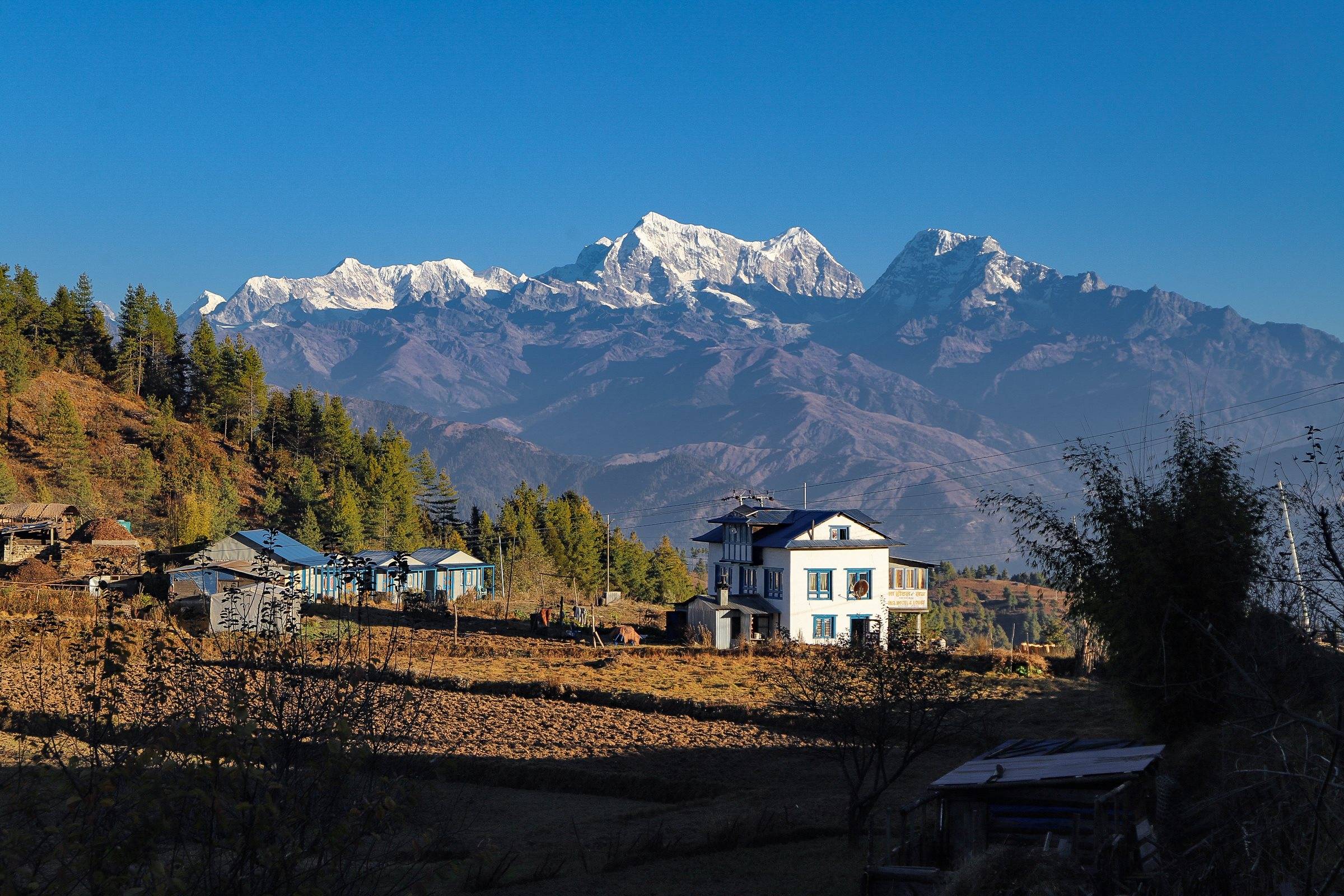
Langtang region is the third most popular trekking region in Nepal. Langtang Valley is described as the most beautiful valley by mountaineers and is a central attraction of the Langtang treks along with the Kyangjin Gompa. It is renowned for its picturesque and distinctive peaks.
The valley between them is one of the world's most beautiful. This narrow valley lies just north of Kathmandu and trekking here offers the opportunity to explore Tamang villages, climb small peaks, and see glaciers at a comfortably low elevation. Much of the route is through semi-tropical forests where moss covers the ground and lush fern and orchids cling to tree trunks.
When you choose the Langtang Gosainkunda Trek, days begin with breakfast at the tea house where you stay. You will need to pack up your duffle bags before breakfast, as porters will set off early. To cover the magnificent sun rays that strike the mountains, you will be on the trail by around 8 am.
A lunch stop for a leisurely lunch will be around noon. Lunch usually takes about 2 hours, allowing plenty of time to explore the village or relax. The afternoon walk is shorter and you usually arrive around 4 pm leaving time for excursions to nearby sites, nunneries, exploration of the village or simply relaxing with a book and catching up on your diary. Dinner is generally around 7 pm.
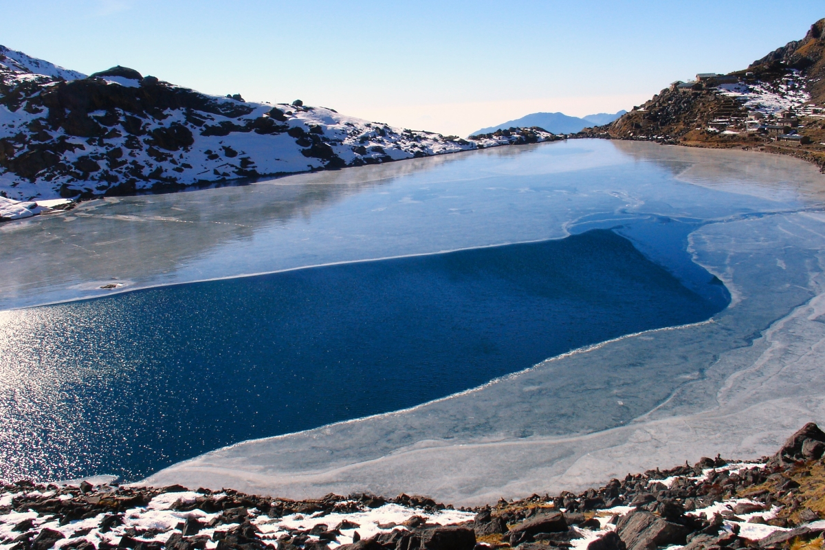
Gosainkunda is another outstanding trekking region, surrounded by the sacred Himalayan Lakes. Hindu and Buddhist people feel grateful to make a pilgrimage tour to Gosainkunda Lake. Gosainkunda Lake is a famous Hindu pilgrimage site in this region and pilgrims from foreign countries visit especially on the full moon day festival.
There is a great mythological story about Lord Shiva about this lake. Gosainkunda also offers sparkling views of other ponds nearby best viewed during sunrise. We will then follow the steep path towards Ghopte followed by Kutumsang and Thare Pati bhanjyang through forests, terraced fields, and small villages inhabited by Tamangs.
Finally, our Langtang Gosainkunda trek ends after trekking towards Sundarijal followed by an hour's drive back to Kathmandu. Gosainkunda (4380 m.) which crosses into Laurebina Pass (4610 m) further to Dhunche. Along this route, you will have an opportunity to experience the whole range of Himalayan topography as the trail heads south through a lush green valley before returning to Kathmandu.
9hrs ride in a wheezing bus to get to Syabrubesi. About 45 minutes out of Kathmandu, you pass through the town of Kakani where there are great views of the Himalayas. For part of the way the road clings to the edge of a steep mountain. Dhunche is an attractive village with large stone houses. Here, there is a police check post where you must show your entry permit for the Langtang National Park , which you’ll be trekking through. There are excellent views of Gheng (6581m) and Langtang Lirung (7246m) to the north and Ganesh (7460m) to the west from Dhunche. From Dhunche there is a descent to the Trisuli River which is reached within half an hour. From the river bed there is a steep climb to Dovan. Right from here a track to Gosainkund leaves the main train to Rasuwa Ghari and the Langtang Valley. From Dovan there is a gentle climb to 6,400ft. and Barku village is reached. From Bharku, traversing up and down after crossing a suspension bridge over the Langtang River, the village of Syabrubesi is reached.


Descend through the village of Syabru and continue down the ridge until you come to a trail to the east that drops sharply off the ridge and through a dense forest. Trail starts meandering through the cool deciduous forests of oak and maple that cover the lower sections of the valley and climbs through massive stands of spruce, fir and blue pine. Towering walls close in and your paths will skirt precipitous drops, which fall into a silt-laden river below. Cross a bridge (1960m) over a tributary of the Langtang Khola and then climb up from the river and in an hour, shortly after the trail levels off, you join the old Langtang trail from Syarpagaon and Syabrubensi. Another hour from this trail junction brings you to the Lama Hotel in the tiny village of Chongong.


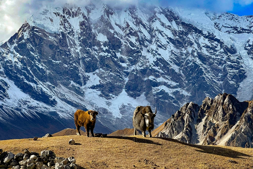
A day further on the forest peters out and you start getting the first tantalizing glimpses of snow-capped peaks. From the Lama Hotel the trail climbs steadily to Ghora Tabela with glimpses of Langtang Lirung (7246m) through the trees. At Ghode Tabela the trail leaves the forest and a spectacular view of Langtang Lirung appears. Continue up the valley, leaving the forests behind, the trail ascends steadily up to Langtang village, passing below a monastery about 30min beforehand. Langtang is an interesting Tibetan-style village with stone- walls enclosing houses and fields where you just might see your first yaks.


Leaving Langtang, you ascend gradually to a chorten (a small Tibetan Buddhist stupa) behind which is a very long Mani wall. The trail passes two small villages and the village widens. You cross some streams and a moraine before arriving at Kyanjin Gompa. Between Langtang and Kyanjin Gompa, the views just get better and better where you’ll see Yansa Tsenji (6580m) and Kimshun (6750m) to the north and the Langtang Himal to the northwest. Alternatively, take a good rest and allow your body to acclimatize with the high altitude as much as possible to be fully prepared for more ascending during the next day.


A day hike further up the valley past the airstrip will provide more spectacular views that include Langtang Lirung (7246m), Ganchenpo (6400m), Langshisa Ri (6320m), Dorje Lakpa (6700m), Lenpo Gang (7100m), and Urkinmang (6170m). A 4hr walk to the east of Kyanjin Gompa from the village is 5000m Tserko Ri. If you start early in the morning and are well-acclimatized, you should be able to climb this peak and return to Kyanjin Gompa in 1 long day. The reward for climbing to the prayer flags on its summit is a magnificent view of the 7246m Langtang Lirung, the mountain that dominates the valley. Several of the more moderate local peaks are quite climbable and provide breathtaking panoramic views of mountains in Tibet , including the 8027m Chisa Pangma.


Since you will be acclimatized and will be descending, we trek down all the way to Ghoretabal through the same trail in a day as walk from Kyanjin Gompa.


You have to trek descending all the way passing various oaks forest and follows the rivers with suspense bridges to reach the Bamboo. Overnight at lodge.


From Bamboo the trail is little bit descending up to the Pahiro and then you have to climb up to reach to Thulo Syabru. On the way you will see various animals like monkey, bear, and various species of birds. This place is the settlement of Tamangs and also famous as Tamang village. You will see the culture ofTamang aolong with various monasteries and stupas.


Leaving behind the pleasant village of Syabru , climb past the gompa, school and army post, and switchback up the steep hill above the village. There are a few houses and potato field’s steep trail and pleasant teashops in the settlement of Dursagang. The trail continues less steeply, now mostly in forests, past an old chorten to the top of the ridge and two shoddy teashops. Coming out of the forest, the trail climbs a bit more before reaching the top of the ridge. The trail continues across the head of a second valley, and then reaches a final ridge. The small Buddhist monastery of Shing Gompa is about 100m along the trail to the left.


From Shing Gompa the trail continues climbing steadily through rhododendron forest with the Trisuli Khola far below. The trail crosses over to the Langtang side of the ridge you are climbing and stays in deep forest for a while, then emerges onto a saddle at Cholang Pati then entering the Gosainkunda protected area where the killing of animals, lighting of wood fires, and grazing of goats is prohibited. There are good views of Langtang Lirung from the north side of the ridge, and looking west, you can see the Mustang, Himalchuli, and Manaslu. You cross high altitude summer pastures for sheep and goats before going back to the south side of the ridge overlooking the Trisuli Khola. When you cross to the south side of the ridge the trail becomes much narrower than it has been up to now, and finally be able to see the first of the largest lake, the holy Gosainkunda, which is evident from the large stone Shiva lingam and the guesthouses around its shores, Saraswati Kund from here


Leaving Gosainkund, the trail skirts the shore of the lake before ascending towards the Laurebina Pass 4610m. The trail now descends, steeply at first but becoming more gradual, to the southeast on a rocky path. In about an hour you’ll come to some roofless stone herders’ huts, and from here the trail descends another ridge, crossing several streams and passing two waterfalls. After passing another stone hut, you climb to another ridge and Ghopte, where overhanging rocks form a cave that is used as a campsite by trekkers can see the lights of herders.
From Ghopte, the trail descends to more caves and enters a thick forest of Pine and rhododendrons. After crossing a stream, which is dry for part of the year, the trail will make a final ascent to Tharepati (3490m), a grouping of small stone huts used in the summer months by herders.


You have to trek descending all the way and can have panoramic view of Mountains including Annapurna, Masalsu. If you are trekking in Spring season, you will see the forest covered with Rododendron. Overnight at lodge


From Kutumsang, in early morning we can see the sunrise over the snowcapped mountains. We would have breakfast served around 7:00am. After breakfast, we start our trek to Chisapani (2194m). It takes about six hours to reach. Chisapani is another view point of sunrise and sunset. Besides, we would explore tribal culture and mountain lifestyle. Overnight at Chisapani.


Chisapani is one of the best places from where one can enjoy the super views of Himalayas, wonderful, Hills & sunrise/sunset views can be seen. You will see the Tamang Habitants and will follow the trail across the Mulkharka and Shivapuri National Park. Then drive Sundarijal to Kathmandu which takes approximately an hour from Sundarijal



Discover incredible offers for your upcoming adventure by subscribing to our newsletter with the latest travel tips and updates.
