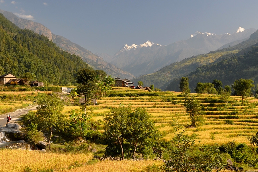
We take an hour-long flight from Kathmandu to Nepalgunj, located in Western Nepal. Our scenic flight over the terraced hillsides and thatched villages of Nepal’s green middle hills takes us to Mahendra Airport in Nepalgunj, the largest city in the western Terai. Nepalgunj, set in the steamy plains of southern Nepal, less than ten kilometers from the border of India, is a jumping-off point for many flights and buses into western Nepal. Nepalgunj, a town near the Nepal-India border, is also the gateway to Simikot, Humla. The town itself is an interesting Terai town that showcases the diverse culture of Nepal. In Nepalgunj, we can visit the local market, mini-zoo and nearby villages. It is quite hot and tropical. Overnight in Nepalgunj


On the following day, we take an early morning flight from Nepalgunj to Jumla. The flight to Jumla passes south along the Dhaulagiri range and provides lovely view of Nepal’s western landscape. Jumla, one of the highest rice- growing areas in Nepal is located on the banks of the Tila Khola at the height of 2370 meters. The peaceful surroundings are enhanced by the reflection of the hills in the Lake’s bright blue waters. On reaching Jumla, we traverse northward out of the Jumla Valley. Soon after trekking for an hour, we encounter a small village of Micha bearing a small walled enclosure and a number of Buddhist stupas. These stupas were erected at around late 15th century, in the memory of important dignitaries of the region.


Leaving Jumla, we continue our trail crossing through birch, pine forests and grassy pass. Further on, we descend as the trail opens into lush forests. From a top the ridge, we can have the most spectacular views of the mountain ridges to the south and Jumla below. Further on, we ascend steeply to the first night’s campsite. . We meet tall birch trees on our way to the Khari Lagna and Danphe Lekh.Passing through Khari Langa Pass, we continue our trek towards Danphe Lagna.


Today our trail follows the northern bank of the Sinja Khola passing through the hotel and health clinic under the massive overhanging rock at Kabra. Silaji found in this area is the source of the important medicinal mineral which is believed to cure almost anything. We come across several small chortens, alpine-like pastures, walnut groves and a narrow valley. Finally, the steep slope guides us into the village of Chautha where we conclude the trek of the day.


Commencing trek from Chautha, we have an ascending trail up to Ghurchi Lagna Pass. Then we pass through farmland and then enter the village of Pina. Pina has a police post and some hotels. Leaving the beautiful village of Pina, we continue our trek towards Dhotu. Overnight at Dhotu.


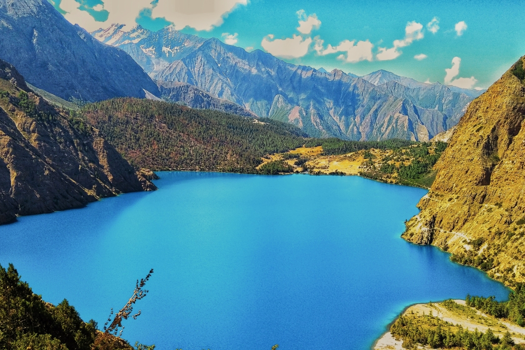
On the following day, we follow the river upstream to Rara Lake, where we savor the most fascinating trekking experience amid the beauty of nature. The trail is not as strenuous as it looks. On reaching the crest of the ridge, we get to experience an excellent panorama to the south, flaunting irresistible beauty and charm. As the trail descends, Rara Lake becomes visible on the northeast. The trail further passes through bamboo and birch forests before reaching Rara Lake. Overnight at Rara Lake.


We will take our first and last rest day throughout the trek. Rara Lake is only eight kilometers west of Pine. We can explore the area, including the old village of Rara Lake. The village site of Rara (3040m) on the north side is a pleasant two hours walk along the western bank of the lake. We can also climb up to the wooden observation tower behind the post office for fine views of the lake and surrounding hills. We can even visit the National Park Headquarters. Swimming is allowed in the lake and it is piercingly refreshing. This can be a perfect way for acclimatization. Overnight at Rara Lake.


From Rara Lake, we walk the lake outlet (2980 m) and follow the downstream of Khatyar Gad for an hour. There is a log bridge over the stream below Murma (3139 m). Crossing the bridge to the south side and climbing steadily over 400 meters, we reach an open clearing at 3277 meters. The trail continues climbing south through dense forest until the tree line is reached at 3658 meters. The ridge continues to south for another 200 meters but it is pleasant trail with distant view of the mountains. There is no pass on this high ridge and the trails turn south-east at an altitude of 3749 meter and descend by the east side of Chuchemara Danda. It is a fairly steep descent to Ghorosingha (3271m).


Leaving Ghorosingha, the trail goes down the valley to Botan (2895 m). It is an interesting trail with better scenic prospect to climb Diyabala Danda south of Ghorosingha. The climb begins immediately west of Ghorosingha and takes about an hour through forest to top the crest at 5351 meters. The sinuous route winds up into terraced farmland and beautiful valley. The trail then skirts south-east above the high fields of Lumsa. There are good views to the south along the Sinja valley. We follow the trail along Ghatta Khola amid the unparallel beauty of nature. The trail descends to Okharpati village (3100m) on a high shelf above Mindrabali Gad. The descent from Okharpati to Sinja takes less than two hours. Sinja village rests upon a small alluvial plain on the west bank of the clear Lah Gad River, also called the Sinja Khola. Sinja was once the ancient capital of the Malla kings. There are stones lying along the trail that foretell the history of Malla dynasty.


Commencing trek from Sinja, we cross the log bridge over Sinja Khola to the east and follow the south bank of Jaljale Gad beyond Kotgaon near Lamathada. We follow the stream for another five kilometers due east. Then we ascend the ridge (2865m) briefly to descend to the same stream again. The trail clings to the south side of the stream all the way for another nine kilometers. The trail twists and turns along the stream but it is a pleasant trail amidst forest wilderness. The trail passed through the pine forests of terraced farmland. En route the trail passes the 300 year old Kanaksundari Temple. The temple holds immense religious significance for Hindus. Overnight at Jaljala.


In the very last day of our trek, we continue our walk from Chere Chaur. Chere Chaur is a delightful alpine pasture where flowers are in profusion during later summer. It provides good views of the Jumla town, Tila valley and Chyakhure Lekh beyond. The return to the town camp is pleasant descent in slow stages. Following the trail gently sloping downwards, we march towards Jumla. Utmost caution is required while trekking along this trail. After reaching Jumla, we can spend our afternoon exploring the busy market town or simply pursuing whatever we feel like. Overnight in Jumla.


We take an early flight from Jumla to Nepalgunj. On reaching Nepalgunj, we return to Kathmandu on the next available flight. After arriving at Kathmandu, you will be transferred to the respective hotel where you will spend overnight.


Discover incredible offers for your upcoming adventure by subscribing to our newsletter with the latest travel tips and updates.
